Unflappable
Out in the wild marshes of western Sandusky Bay, more properly known as Muddy Bay for reasons dramatically exhibited by one footstep offshore, there lie the feeding grounds for ducks migrating from Canada, resting and refueling mid-way, en route to their wintering grounds in the south. The duck hunting clubs have preserved thousands of acres of this marshland in the hope of luring those migrants in range of their guns. But that takes place late in the day. At 10AM we gathered to do our own duck hunting, armed with binoculars, canoes and kayaks and the determination not to get all that bottom muck from our boots into our boats. In this latter effort we abysmally failed. But we did get to see the ducks.
10AM: In alphabetical order – Betsy, Brad, Colleen, Edie, Heike, Joni, Judy, Marty and Rick launched from the banks of Muddy Creek and struggled to get free of the bottom.


Winding our way around the thin fingers of marsh, views blocked by the high marsh grasses, we came out upon an open area and there they were! Several dozen ducks bobbing in the shallows, apparently unaware of our presence. Stealthily we crept up on them, paddles barely making a sound, breaths baited, hearts pounding...two hundred yards, one hundred yards, fifty yards, 20 yards, ten feet, not a one of them moved. Unflappable. GOTCHA! as I whapped the back of a plastic duck decoy with my paddle. Dinner denied. We paddled on.

In the open waters of Muddy Bay we held to the north shore. The south winds were predicted to rise in the afternoon and rain to fall by late afternoon. By sticking to the north shore early in the day, we’d cross over to the more protected south shore in the afternoon and keep out of the rough stuff.

A few ducks in the distance rose upon spotting us, and wheeled away to the south. Further on, as we came closer to Winous Point, housing the duck hunting club whose advice I sought as to the arrival of the ducks, a much larger flock took wing, hundreds and hundreds of them. Too far away to make identification even with binoculars, as we all stopped paddling and strained our eyes to see them. Then they too wheeled away to the south. We were heading that way anyhow and we’d trick them paddling up from behind to catch them again later in the day.


 Click on the image for an enlarged view; the specks in the sky are the ducks
And then the winds rose, earlier than expected, catching us on the far side of the bay with several miles of fetch between us and the south shore; short choppy waves caught us exposed and broadside. After taking a few slops over the gunwales of the canoe, we turned south towards Squaw Island, a tiny bit of land housing a channel marker for the nearby Sandusky River, and then further to the protection of the south shore. It was a slow but steady slog. Betsy, Brad and Heike up ahead. Rick, Judy and Colleen behind. Joni sitting in the middle of our canoe in the middle of the group. Colleen told us afterwards she thought she was making almost no progress at times. We counted forward motion by the inch. The winds pushing against us at 20 knots. Some whitecaps, some slop and spray aboard. Looking back to check on some of our boats behind I got a full dollop of water square in my ear.
Nice bay.


We followed the south shore across to the entrance of the Sandusky River, upstream of which only Judy had been. On a lonely point of land with a prominent tree we made landfall and lunchfall. Pretzels from Rick, bagels from Heike and a marvelous vegetarian pate (‘pahtay’) from Joni. Colleen and Betsy modeled their fancy drysuits, exhibiting hard to reach zippers and monkey-butts (their term for the lower rear part). Judy had on her bright, colorful Jet-Ski wet suit pants, but Rick stole the day with his electric green plumage. Everyone had a bagel. This is a nice landing spot in an area that is mostly marsh. Enough room and logs for good seating, and enough privacy for a bathroom break off to the sides.


As the day waned we launched, or at least tried to. The increasing southerly winds were blowing the water out of shallow Muddy Bay and I had to walk the canoe with both princesses (Edie and Joni) relaxing aboard, polishing their nails and leaning back just far enough to receive grapes dropped from the skies.
I slogged onwards until the water covered my boots, then hopped aboard and paddled the bottom mud to freedom.

Along the way we spotted a large bird that was identified as a juvenile bald eagle, sitting high in a tree.
Click on the image for an enlarged version; the eagle is in the tree behind the lead kayak.

But no ducks. They were crafty fellows, obviously used to the ways of man, and we were hardly a match for the clever machinations of critters who’d eluded the gunfire year after year. We never saw them again.
We did run through the flotilla of decoy ducks just to annoy them and then approached a large flock of gulls who let us get very close before taking flight, their white wings in stark contrast to the grey skies.

And then it was mud again, all the way to the shore, lots more than when we started because of those south winds blowing the water out. There have been times when the entire bay was a sea of mud and absolutely unapproachable. It might be that way this evening, but we’d made our escape while there still was time. One wonders what might have happened had we delayed our return until nightfall. An evening on the bay? Another day or two on the bay? Waiting there stuck in the boats until the winds dropped and the Lake Erie seiche allowed the water piled high on the Canadian shore to slosh back and free us?
Just as we loaded our boats and started our cars, the first drops of rain appeared. We smiled smugly, ignoring the mess in the back where boots, paddles and clothing smeared with mud left a sticky reminder of what might have happened. There would be a reckoning with a sponge and a vacuum cleaner shortly.
Marty Cooperman
Photos by Edie and Joni, princesses
Photo Album
 Above are the ducks.
If you click on the image, you will see an enlarged image.
The black specks filling the sky are the ducks.
Here are some more ducks. They were not shy.
 They were "unflappable."
They were plastic.
We also encountered the ubiquitous flock of seagulls.

The gulls flashed silvery-white as they took wing.

 The quintessential late autumn sky and lake.
 Native kayakers sport outrageously colored plumage.
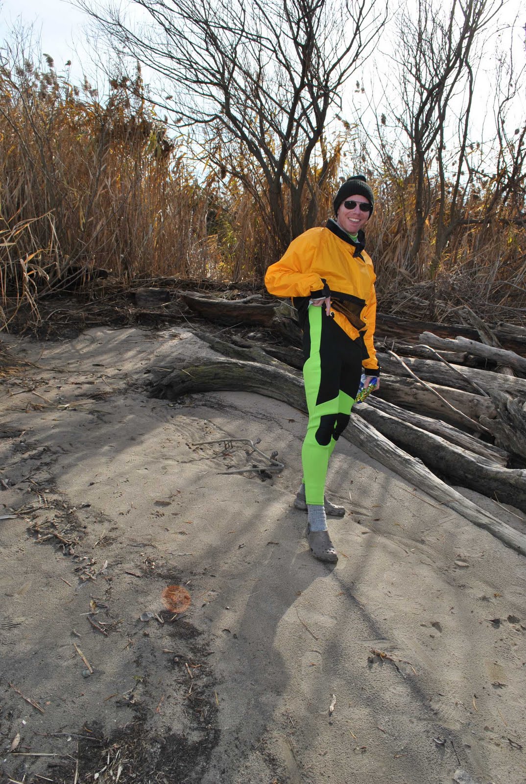 Here is Rick, modeling his plumage, er, neon neoprene to great effect. Sleek and chic!
 Betsy and Colleen strut their iridescent blue stuff, shaking their tailfeathers
and boasting about their envied monkey butt profiles.
 Marty sports a rainbow effect and Heike is radiant in her hi-vis crown tuft.
 I believe the entire color wheel is represented here!
 Marty is high on bagels!
 What a bright splash of psychedelic color we are!
 Brad practically glows in marigold.
These folks know that a little bit of black makes the hot colors pop!
 Bright sky blue and tangerine are two complementary colors Joni chose
for a sophisticated yet adventurous look.

The black trousers snap up Joni's color while she snaps away!

Heike strikes a pose.
Lunch spot below.


