Monday, September 14, 2009

Quetico 2009: The Mood Is Set

This is a story about a canoe voyage.
The voyage took place in a Provincial Park, Quetico. Quetico is a wilderness park and is located in a particularly beautiful area of the Canadian Shield in western Ontario. It borders the U.S.'s Boundary Waters. There are no roads, no trails, no electricity, no cabins, no motorboats, no cell phone reception, no rangers, no signage, no logging, few people and plenty of open space, wildlife, lakes and various connecting waterways.
Marty and I first visited in 2004 and knew immediately that we would be back again someday.
That someday came in August 2009.
The mood was set indeed on our drive in on the last leg of a two-day drive. The clouds overhead were quite 'moody,' dramatic and changing rapidly.
This was to set the tone of our visit. Rapidly changing weather, moody skies and dramatic portages.
Read on.
For those interested, here is our route:

Dawson Campground (night 1,)

French Lake, Pickerel Creek, The Pines Pickerel Lake (wind-bound Night 2,)

Pickerel Lake balance, Bisk Lake, Beg Lake, Bud Lake, Fern Lake, Olifaunt Lake, Sturgeon Lake (night 3,)

Sturgeon Lake (wind- and rain-bound Night 4,)

Sturgeon Lake balance, Sturgeon Narrows, big Sturgeon Lake (wind-bound night 5,)

big Sturgeon Lake, Maligne River, Tanner Lake, Maligne River, Maligne Creek, Minn Lake (night 6,)

McAree Lake, Namakan River, Crooked Lake, Little Roland Lake, Middle Roland Lake, Roland Lake, Roland River, Argo Lake (night 7,)

Cone Lake, Brent Lake (wind-bound night 8,)

Unnamed Lake, Conmee Lake, Poobah Lake (night 9,)

Poobah Lake balance, Berniece Lake, Allen Lake, Allen Creek (about face!), Allen Lake (night 10,)

Berniece Lake, Poobah Lake, Poobah Creek, Maligne River, Sturgeon Lake sand point (night 11,)

Sturgeon Lake sand point (wind- and rain-bound all day,) then to Sturgeon Narrows in the evening (night 12,)

Sturgeon Narrows balance, Sturgeon Lake, Olifaunt Lake, Fern Lake, Bud Lake, Beg Lake, Bisk lake, Pickerel lake (windbound night 13,)

Pickerel Lake balance, Pickerel Creek, French Lake, home.

This route included approximately 56 portages. That is 4.5 portages per day, but we made up to 10 portages on some days. Yikes.

Quetico: All Natural, All The Time


Never mind the mood for now; here are some pictures to set the scene. Quetico is rich with textures and wildlife.
And wild blueberries!
Ahhhh, wild blueberries, tiny, but packed with sweetness. The grocery store blueberries are no comparison. We specifically timed our trip to coincide with wild blueberry season.
The ground beneath our feet was solid Canadian shield rock but luxuriously cushioned in many spots with a richly patterned carpet of moss and lichen.

There were many different species of pines, each with its own distinct scent in the summer sunshine.
Mushroom aficionados would have been very busy thumbing through their guidebooks. There were more than I could hope to photograph.
And nearly every time you looked over your shoulder you would see this silhouette in the tallest dead tree skeleton.
A bald eagle.
And while you were busy looking for mushrooms, you might see this silent sun dweller.

Quetico: Things Over Which We Have No Control


The Maps Were Frequently Inaccurate and The Portages Were Hard To Find.

This is Marty enjoying the Allen Creek. On our map Allen Creek looked like an interesting shortcut out of remote Allen Lake back into the more populated areas of the park. It was a mere wiggly blue line of a route crisscrossed by several portages.

Marty's postcard commentary tells it best:

"Our great adventure started heading east out of Poobah Lake to Bernice Lake to Allen Lake and then to Allen Creek. We missed a portage (wrongly marked on two maps) and had to create our own, armed only with a folding saw, a cheese knife and the pointy end of the canoe as a battering ram. After 3 1/2 hours hard labor we emerged on the far side of the forest and wound up in a meandering channel that degenerated into a weed-choked beaver swamp that turned into a beaver dam that began to look dubious. It was 6pm and either we were going to spend the night in the canoe or we were going to retreat. What to do? We made a fast retreat only to find the missing portage on the right taking all of 15 minutes for us, the canoe and the gear. You could hear the gnashing of teeth echoing off the rocks. In desperation, as darkness was falling, we landed at the nearest rock outcrop that would hold a tent, got the gear organized, ate dinner in a haze of mosquitoes and hunkered down for the night.
Wish you were here- Marty & Edie"

Near the top of the Things Over Which We Have No Control List is "Weather."

Our first afternoon in Quetico was marked by increasing wind. A head wind. And raggedy waves. And a long distance. We were stopped by early afternoon on a lovely sand beach. The waves crashed on the shore all night. I amused myself by leaning against the overturned canoe doing needlework and recording the changing clouds and setting sun with my camera. It was pretty, the sun and sand were warm and it felt good to relax.

Marty took a nap and kept a sharp eye on the wind and waves.
The next morning was eerily quiet. The lake and skies were calm. It was time to travel and we did.
More weather comments:

Above and below depicts a brief low pressure system that passed overhead one gorgeous evening. It blew in dark clouds and (I assume) the high pressure system right behind it blew them right back out. It lasted all of 45 minutes. Bizarre.

And the wind...! Canada's high pressure systems jockeying for air space with the U.S.'s low pressure systems generated plenty of wind. Head wind. And some rain. This is our second full day on the trip waiting out a chilly gusty steely gray day tentbound.

I got tired of doing needlework
Marty eventually got tired of memorizing possible routes on the map and making elaborate trip notes.
So all we had left to do was... ham it up for the camera. And even that half-heartedly...
We were in paradise... and we were bored.


Friday, September 11, 2009

Quetico: Baggins

We made some new friends on our travels through Quetico.
Meet Baggins.
Baggins was camping with his two-leggers, Bruce and Catherine, on a beautiful sand point on Sturgeon Lake. We stopped there for lunch one blustery afternoon. It was a combination of a relentless head wind, Baggins' excellent companionship and Bruce and Catherine's wonderful storytelling that inspired us to call it an early day, set up camp and wait out the wind until the next day. In the meantime, Bruce, Catherine, Marty and I exchanged canoe camping horror stories and prepared food to share all around. It was an evening of the best that Quetico had to offer; a lovely sunset, a fabulous meal and even better company.


The next morning, early, I heard Baggins' collar bell clanking outside our tent; he had come to wake me up. He had something to show me. He drooled luxuriously on our tent screening waiting for me to dress.

"Follow me."
I did.


"I have something neat to show you; you'll really like it. I do."
He showed me the mist on the now silk-smooth lake.
"Nice, huh?"

"Walk this way; there's more."


"Look at these logs!"
"This one's my favorite; It's really stinky!"
"I come here every morning."
"And then I go back to the tent to see if any kibble has appeared in my dish."

"And then I watch the sun come up."


"And dream about all things stinky."

Quetico: The State Of The Portages


Let me tell you about portages.
First, a definition and pronunciation:

por-tage [pawr-tij, pohr-tij, or for 2,3,5,6, pawr-tahzh]
-noun

1. the act of carrying; carriage.
2. the carrying of boats, goods, etc., overland from one navigable water to another.
3. the route over which this is done.
4. the cost of carriage.

–verb (used without object)
5. to make a portage: On this stretch of the river, we have to portage for a mile.

–verb (used with object)
6. to carry (something) over a portage; make a portage with: We portaged our canoe around the rapids.


Portages are the trails that lead from one body of water to another. They are either a necessary evil or a very welcome leg stretch. In order to accomplish a successful portage, you must carry all of your worldly camping goods AND YOUR CANOE on this trail.
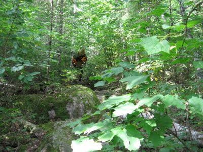
Many times they are very nice walks through beautiful forests like the one above.
And their nice flat open landings on the shorelines are easy to find and have plenty of dry land on which to unload and unload all your gear.


They have good footing and are clear of rocks and low hanging branches so that carrying a canoe is just another walk down the sidewalk.

But others can have different "features," shall we say. Here I am demonstrating technique on some slick mossy boulders cluttering up the path. That meant that Marty, wearing his 18' canoe as a hat, had to do the same maneuvering. Except without being able to see where he was going.

Look out for the boulders, Marty.
Okay, now step up 3 feet with your right foot...
Okay, got around that one, now twist your left foot ninety degrees and feel with your toes for that pointy rock...
Good, now the nice flat one surrounded by mud... look out for that log... *ouch*
now big step down,
That one's really slippery, watch out, and you're there!
Other portages were little more than a dash over a rock hump, a carry-over. This one went around a beaver dam.
Another portage took us up a pine needle carpeted steep hill through a dense forest. To our surprise there was a rushing river through these thick woods! It rushed in without a care for the trees crowding it on either side,

plummeted over two massive granite stair steps,
careened and cornered recklessly close to stately pines,


And finally, tamed, ended in a meek sluice at a sandy beach.
When we acquired our 'backcountry permit,' the gal helping us with our paperwork that "it's been an unusually cool and wet summer."
We now know what this means in polite Canadian parlance is "The portages are a mucky mess and the wild blueberries aren't ripe yet."

Although this leads me to my favorite portage story of the trip. The blueberries were indeed not yet ripe anywhere in the park. We found a few, very few, here and there but they lacked that intense sweetness. Meanwhile, Marty was insistent that we tackle the Memory Lane portages. These portages are a series of three VERY long and difficult portages into Poobah Lake, an unusually landlocked though picturesque lake known for phenomenal fishing. We did these portages one hot, sticky afternoon and they lived up to their reputation. One extended boggy marshy section of the trail was thick with "corduroy" (logs laid lengthwise to provide some semblance of footing, usually very slippery) and hidden muckholes up to one's knees. However, this bog went through a very open area, almost a field. This field was home to the familiar, squat, unremarkable bushes that we recognize as wild blueberry bushes. Except these bushes were miraculously laden, heavily, lushly, with millions of very ripe blueberries. Marty and I stopped in stinking mud up to our ankles and gorged. We became instant fans of the Memory Lane Portages.

Above is pictured a very modest muckhole on a portage. The mud did a fine job of hiding all the slippery rocks and deep ruts hidden underneath, though it was tame compared to the conditions on the Memory Lanes portages...


Others portages were located under bogs.
This portage entrance was camouflaged as a floating grass mat. It barely supported the weight of the canoe. But we hauled it and ourselves to the small open water leading to the mudhole at the portage landing and unloaded.
Of course we could have simply paddled through the open water at the left... had we seen it...

When it rained, portages became babbling brooks.
And portage landings became frog ponds.

All in the name of the Wilderness Experience!